Something Special!
Featured Presentations
The program planning team thinks the following presentations deserve a closer look.

- The "Lost" Wisconsin - Minnesota State Line
Wednesday, May 23: 2:30-3:30 pm, Bryan Meyer - UMGEOCON Hosts - Lightning Round
Wednesday, May 23: 4:00-5:00 pm, UMGEOCON Host Organizations - GIS in the County Emergency Operation Center (EOC)
Thursday, May 24: 9:00-9:30 am, Randy Knippel - Empowering Communities & Classrooms On the Value of Remote Sensing
Thursday, May 24: 9:30-10:00, Dan Bertalan - Petascale High Performance Computing
Thursday, May 24: 10:30-Noon, Panel
Panels
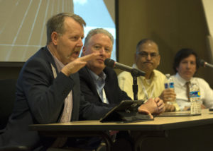
There are two panels brimming with expertise about topics which will directly impact your future in the geospatial community.

- IA, MN, & WI CORS/RTRN GNSS Networks
Norman Miller, IA DOT; Nathan Andserson, MN DOT; Elliot Smith, WI DOT - Petascale High Performance Computing
Mark Korver, Amazon Web Services; Paul Morin, Polar Geospatial Center; Chris Doescher, NASA-USGS; Lanny Faleide, SatShot
Poster Contest
There are some incredibly talented geographers out there who know how to tell the story of "where" with a poster. So get ready to let the world know you ROCK by sharing your work at UMGEOCON.

Simple and straightforward contest. Here are the rules:
- 10 double-sided 4x6 poster boards will be available for self-posting
- First come-first serve, must be posted by the Vendor Reception
- Two award categories:
- Best research focus (best story told)
- Best cartography (best art of the map)
- Ballots will be provided in the attendee packet.
- To encourage voting, 3rd place door prize will be drawn from the ballots submitted.
- Contest winners will be announced at closing event.
Self Organized Meetings
Need to conduct a meet-up or small group business meeting? The common areas of the UW-L Student Union are the perfect solution.

Dedicated classroom space available upon request and subject to availability for code sprints, regional meetings (USGS, EPA, etc.), or similar.
- May 23 - 7:30-11:30 am
- May 24: 1:00-5:00 pm
